Showing 1–12 of 80 results
-
310,00 €
Between Lesse and Semois is the best option to discover the beauties of the Ardennes in only two stages. The stay combines nature with the valleys of the Ourthe and Semois rivers and culture with the arrival in Bouillon. Europ’Aventure takes care of everything: quality accommodation, luggage transport, any transfers, return trip, etc.
-
260,00 €
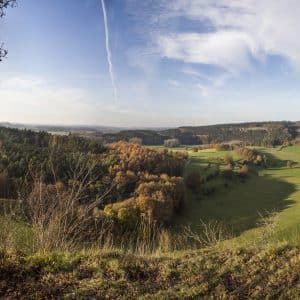
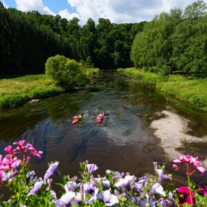
This stay allows you to discover the magnificent region of the Calestienne in the heart of the Geopark Ardenne-Famenne labeled by UNESCO. It is certainly the one that allows the most flexibility because it offers the possibility for walkers to alternate between a walking day and a rest day. It also allows families to travel shorter routes and does not have the constraint of carrying luggage.
-
290,00 €
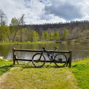
This magnificent star holiday around the La Roche-en-Ardenne region will enable you to discover electric mountain biking. Thanks to our partner, SoWatt, you’ll have access to top-of-the-range electric mountain bikes and can ride some of the region’s most beautiful routes in complete peace of mind. You’ll alternate between forests, countryside, picturesque villages and breathtaking views over the valley.
-
300,00 €
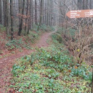
Come and discover the Mullerthal region, often referred to as Luxembourg’s Little Switzerland. A true hiker’s paradise, the Mullerthal Trail takes experienced hikers 112 km through a magnificent hilly region.
-
360,00 €
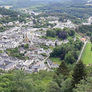
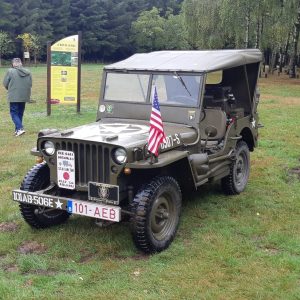
This short stay in the region of Bastogne gives you the opportunity to admire the magnificent landscapes of the Ourthe and Laval valleys during a day trip but also to dive into the history of this part of Belgium thanks to your guided tour in a Willys Jeep. You will be able to discover many historical sites and enjoy the explanations of an expert during this unique experience.
-
790,00 €
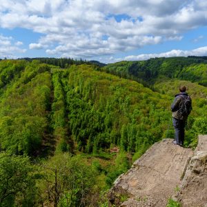
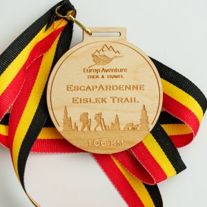
One of the only hikes in Belgium to be awarded the “Leading Quality Trails – Best of Europe” label, the Eislek Trail features a 106 km, 5-stage route through wild riverbanks, romantic plateaus and formidable escarpments. From the north of Luxembourg to the heart of the Ardennes, you’ll find sumptuous landscapes. Europ’Aventure offers you to discover it at your own pace and takes care of everything: quality accommodation, luggage transport, possible transfers, return trip,…
-
15,00 €
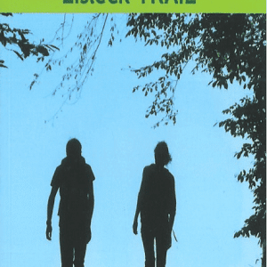
Topo-guide for hikers wishing to cover the 104 km, in 5 stages, of a signposted cross-border route through the Belgian and Luxembourg Ardennes. In this book: the description of the route, information on the fauna and flora, but also the history and heritage encountered…
-
8,00 €
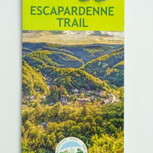
Map for hikers wishing to cover the 104 km, in 5 stages, of a signposted cross-border route through the Belgian and Luxembourg Ardennes.
-
365,00 €
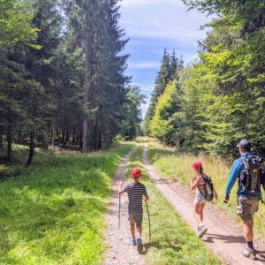
Come and discover the joys of an itinerant holiday in the heart of one of Europe’s most beautiful forests. Thanks to its 3 short stages (12 – 15km), this trip is perfect for families with young children, for novices and also for anyone wanting shorter stages. You’ll be staying in typical, comfortable accommodation.
-
365,00 €
A family plunge into the heart of the Semois Valley nature park. Thanks to its 3 short stages (12 – 15km) and its magnificent scenery, this trip is perfect for families with young children, for novices and also for anyone wanting shorter stages. You’ll be staying in typical, comfortable accommodation.
-
8,00 €
Finisher Medal – EscapArdenne Eisleck Trail – 106 km
-
8,00 €
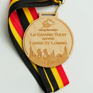
Finisher Medal – The Grand Tour between Lesse and Lomme – 78 km


